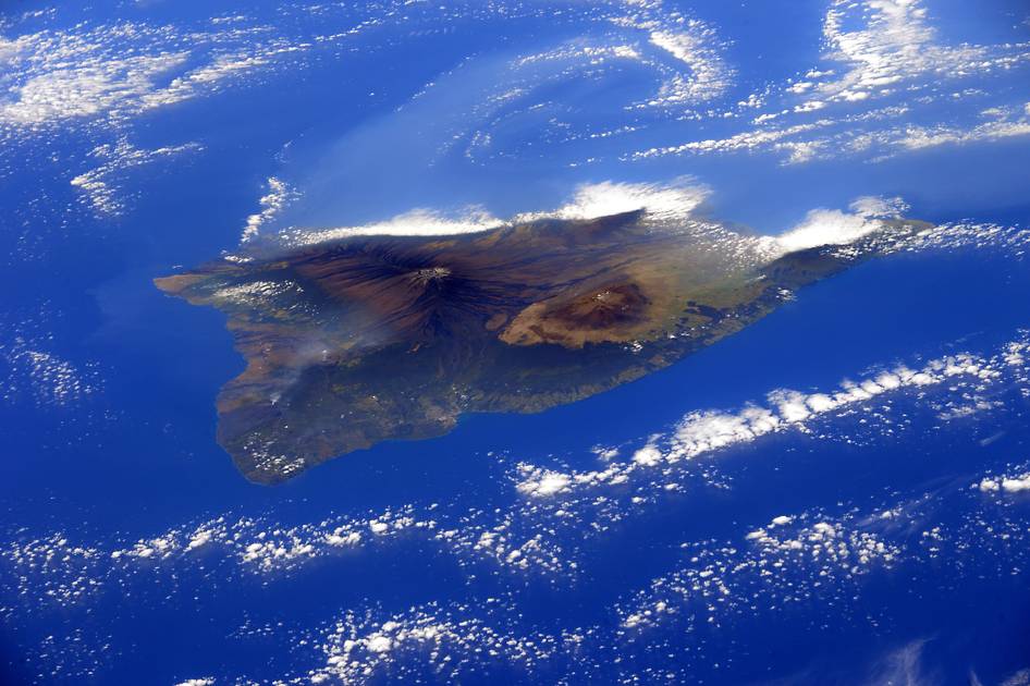
Island of Hawaii From the International Space Station
From the International Space Station, European Space Agency astronaut Samantha Cristoforetti (@AstroSamantha) took this photograph of the island of Hawaii and posted it to social media on Feb. 28, 2015. Cristoforetti wrote, “And suddenly as we flew over the Pacific… the island of #Hawaii with its volcanoes!