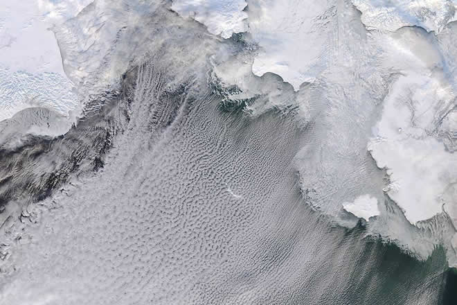
Cloud Streets in the Bering Sea

Ice, wind, cold temperatures and ocean waters combined to created dramatic cloud formations over the Bering Sea in late January, 2015. The Moderate Resolution Imaging Spectroradiometer (MODIS) aboard NASA’s Aqua satellite passed over the region and captured this true-color image on Jan. 23.
The frozen tundra of Russia lies in the northwest of the image, and snow-covered Alaska lies in the northeast. Sea ice extends from the land well into the Bering Sea. Over the dark water bright white clouds line in up close, parallel rows. These formations are known as “cloud streets”.
Air blowing over the cold, snowy land and then over ice becomes both cold and dry. When the air then moves over relatively warmer and much moister water and lead to the development of parallel cylinders of spinning air. On the upper edge of these cylinders of air, where the air is rising, small clouds form. Where air is descending, the skies are clear. This clear/cloudy pattern, formed in parallel rows, gives the impression of streets.
The clouds begin over the sea ice, but they primarily hang over open ocean. The streets are neat and in tight rows closest to land, while further over the Bering Sea the pattern widens and begins to become more random. The rows of clouds are also not perfectly straight, but tend to curve. The strength and direction of the wind helps create these features: where the wind is strongest, nearest to shore, the clouds line up most neatly. The clouds align with the wind direction, so the direction of the streets gives strong clues to prevailing wind direction.
